By: Simon Brooke :: 26 July 2016
I've posted about maps of Scotland before; if you follow the different aspects of this blog you'll know I'm rather interested in maps. In June I posted the EU referendum results map. It sharply delineates Scotland. So too did maps of opinion on Europe prior to the vote.
Professor Jim Gallagher opines in the Herald today that this clear difference of opinion does not indicate that Scotland is any different from England. I'd disagree, but let's look at some other maps.
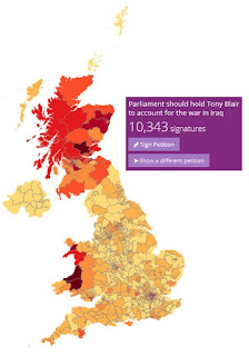
Here's another — apparently unrelated — map: where people petitioning for Tony Blair to be arraigned before Parliament for the war on Iraq come from:
And of course there are more. Here's a quick selection:
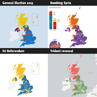
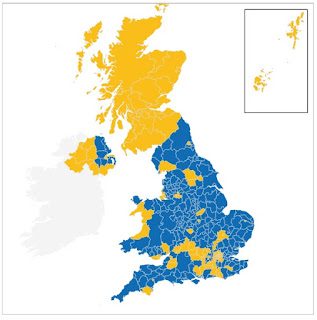
Of course you may reasonably claim that (apart from the EU referendum, which we've seen before) since the first shows the General Election outcome (SNP landslide in Scotland), while the remaining two show the consequences of that outcome in key parliamentary votes. Nonetheless, they're stark.
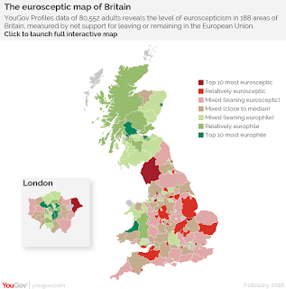
Here's another. Once again, the border between England and Scotland is sharp and clear — and the border between England and Wales completely invisible. Can you guess what this is?
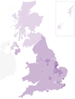
That's a map of the proportion of UKIP voters.
Summary: Scots are significantly more pacifist (oppose Trident, seek accountability for war crimes), less anti-immigration (low UKIP vote), more internationalist (support EU membership), and all these things are equally true across the whole of Scotland — even the Conservative-voting areas — while being sharply different from the overwhelming opinion across England.
In summary, the learned professor is just plain wrong: Scotland is markedly and systematically different from England.
And one more
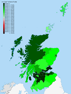
Edited in August 2018 to add one more map which I particularly like. This is data from the 1997 devolution referendum. The areas coloured red (see scale) are those which voted 'No'.
I wonder if you can find them?
Update on Brexit, November 2018
This is Survation data from November 2018. Although much of England has swung to Remain, the border is still clearly visible, with all of Scotland still much more Remain than almost anywhere in England.
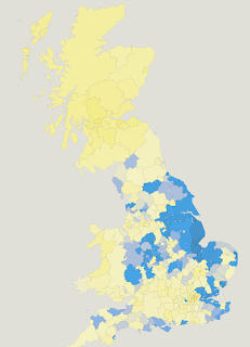
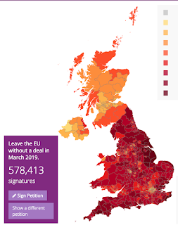
Another update on Brexit, March 2019
This is a map of the signatories to a petition for a no deal Brexit, 27th March 2019.
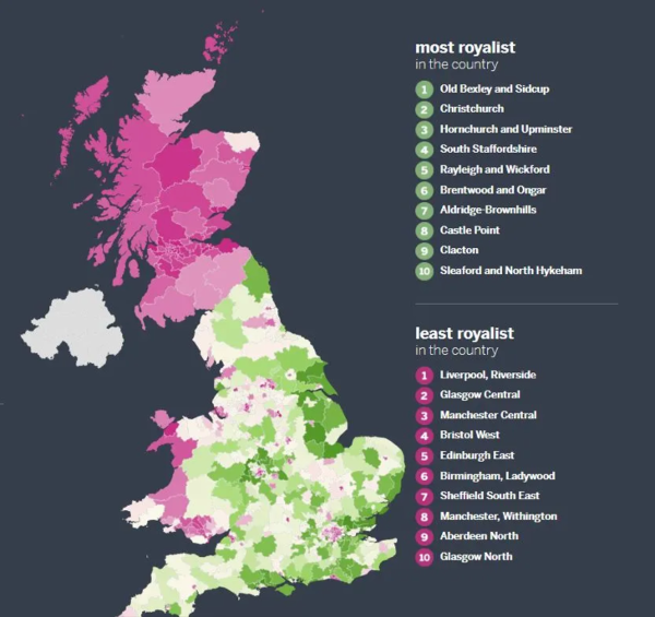
Another update in honour of Her Majesty the Queen's Platinum Jubilee, 2nd June 2022
Posted without comment.
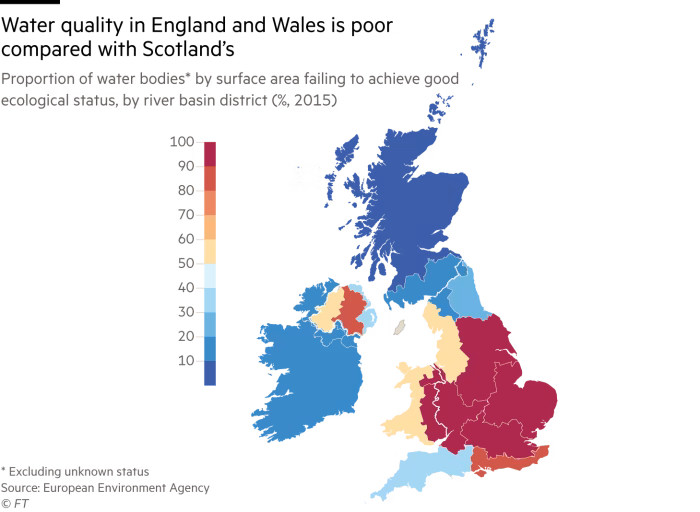
A rather shitty update, 22nd May 2024
It's well known that the public water monopolies in England and Wales are privatised, while Scotlands is maintained in public ownership. What does that mean in practice, for water quality?
Gosh.
You don't say.
Why could that be, do you imagine?